


In the shadows of Nevado Coropuna—Peru’s tallest volcano—geologist Gordon Bromley quietly hacks away at glacial deposits. He is collecting samples from boulders that skated down the mountain during the last ice age. These samples will be processed by a technique called surface exposure dating. In a concerted project with Columbia University’s Lamont-Doherty Earth Observatory, they will isolate the tiny grains of the  mineral pyroxene to measure its helium isotopes. This will be crucial to reconstructing the ebb and flow of ice on Nevado Coropuna since the last ice age, to understand when glaciers on Coropuna advanced and retreated, how the tropics influenced the global climate system, and agricultural impacts in the area.

Kurt Rademaker, an archaeologist from the University of Maine, helps Bromley with geology work. During a five hour walk into a lava field, they discovered stones that were clearly not natural deposits. It turned out to be an ancient Andean road. At roughly 15,000 feet, they further discovered a prehistoric rock shelter – the highest ice age archaeological site known thus far. Rademaker has found evidence of human activity that reaches back to the end of the last ice age. He has found numerous artifacts that were radio carbon dated to 12,000 years ago and based on archaeological evidence, he suggests that the last event in the shelter was cooking before the inhabitants hurriedly left the site.
 Together with glacial geologic chronology, they are establishing precisely when humans occupied and unoccupied the site. This will shed understanding on why those humans left – what were they responding, a change in the local environment? So far, their research findings challenge conventional thinking that the climate was too cold for early hunter-gatherers to survive.
 The concerted project seeks to understand the past climate better, along with wanting to understand what adaptation measures may help humans survive in this hotter world. Archaeology in collaboration with geology will help answer such questions. Archaeology can provide another layer of evidence in reconstructing the ebb and flow of ice on Coropuna. While geology seeks to understand paleo-climate to understand the future and impact on humans, archaeology can yet provide supporting evidence on how climate impacted past humans.
 Coropuna has seen the dissipation of snow twice, once in the last ice age, and in modern day. Temperatures are rising due to industrious carbon dioxide in the air. Coropuna is changing again. It has lost a quarter of its glacier mass since the 1960s. Millions of humans rely on glacial water and water in the arid region is expected to grow even scarcer. Understanding the ebb and flow of Coropuna’s glaciers in the past will be a key to understanding how a rapidly warming climate will impact water availability in the future. Research is still ongoing.
-antonio kuilan
Lamont-Doherty Earth Observatory – Columbia University Earth Institute. Climate in the
Peruvian Andes: From Early Humans to Modern Challenges. June 2, 2013. Web.
https://www.ldeo.columbia.edu/news-events/climate-peruvian-andes-early-humans-modern-challenges

 Indian Ocean, Krakatau is located in the Sunda Straits, nestled between the larger islands of Java and Sumatra in Indonesia. Krakatau is adjacent to two immediate smaller islands: Verlaten and Lang. It is important to note that an ancestral Krakatau volcano collapsed in 416 CE and created a nearly 5 mile wide caldera. Remains of this volcano can be fo
 und on the islands of Verlaten and Lang. By 1883, there were 3 major volcanoes on the Island of Krakatau: Rakata, Danan, and Perboewatan. The 1883 plinian eruptions of these volcanoes were so powerful, that it engulfed two-thirds of the island, slightly over 8.8 square miles. All three towering composite volcanoes were reduced to another large caldera, leaving but a fragment behind. With time, Anak Krakatau was born in 1927, also known as the “Child of Krakatau.” Therefore, when one speaks of “Krakatau,” it generally means the island and its immediate volcanoes.
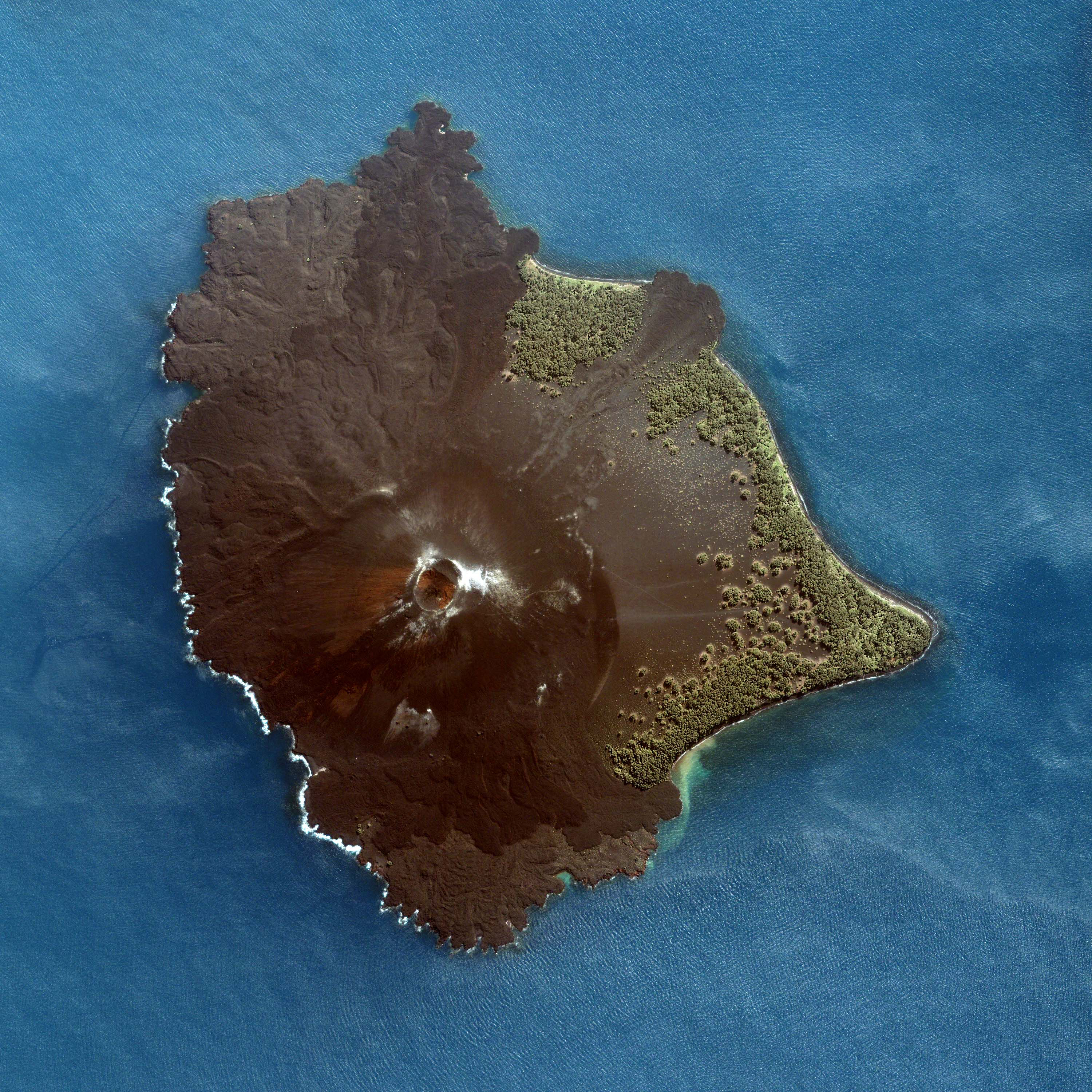
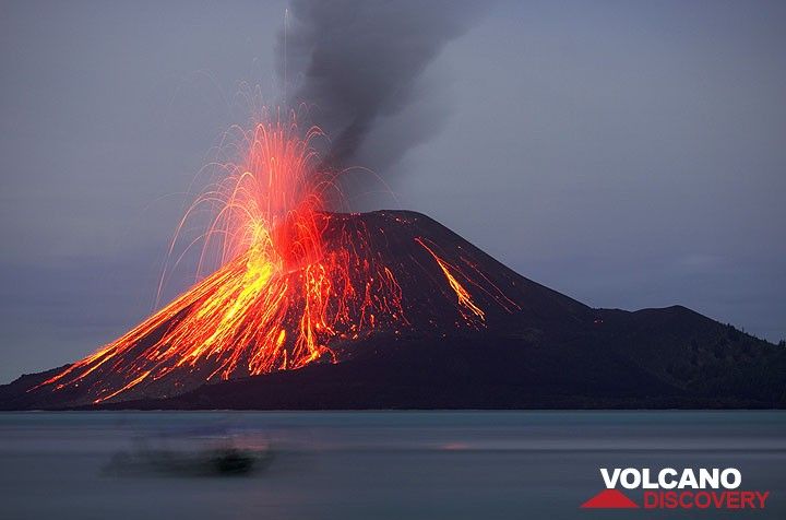 fluid basaltic lava exists at Krakatau, this is referred as “bi-modal,” meaning two modes of magma co-existing next to each other and may at some point mix. It was thought that mixing of the two magmas can set off super explosive eruptions, such as the 1883 eruption, and recent chemical analysis from material ejected from the 1883 blast suggests that bi-modal mixing did occur. The types of hazards associated with Krakatau are lahars, pyroclastic surges, debris, volcanic bombs, tephra, gases, lava, and ash. In the event of an eruption, the immediate coastal areas of Southern Sumatra and Western Java will be the most impacted and the entire regions of Southern Sumatra, Western Java, and Belitung Islands are susceptible to Krakatau’s hazards.